
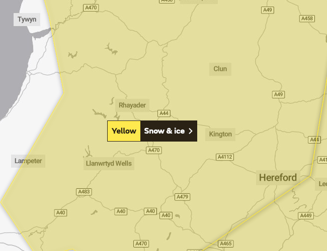
More snow and ice has been forecasted for Brecon and Radnorshire this weekend.
The Met Office has issued a fresh weather warning for Sunday, with a yellow warning for snow and ice in place between 3am and 9pm.
A fresh band snow has been predicted for much of the UK on Sunday, which could lead to some disruption to travel and other activities, before turning to rain later.
The Met office says that travel delays are a possibility, along with delayed or cancelled rail and air travel. Some rural communities could become cut off and power cuts may occur, with the potential to affect other services, such as mobile phone coverage.



The Met Office said: "A band of snow is expected to move northeast across the UK on Sunday, in most places lasting two to four hours before turning to rain. Places in the southwest will be affected first.
"Temporary accumulations of one to three centimetres at low levels, and perhaps locally five to eight cm across the Welsh mountains, with any snow starting to melt readily from late morning.
"While parts of the northeast of England and Scotland will probably stay dry until late morning, the feature becomes slower moving here allowing for larger accumulations.
"Temporary accumulations of one to three cm are likely at low levels, with five to 10cm more typical across upland areas and isolated 10 to 15cm on high ground north of the Central Belt.
"Once rain becomes established, all lying snow will melt rapidly. In addition to the snow and ice, strong winds are expected across all parts, with gales or severe gales mainly across high ground.
"This will lead to blizzard conditions in some areas for a time. A brief period of freezing rain is also possible, most likely to impact areas from the Pennines northwards, with a consequent risk of ice accretion on structures and power lines."
Comments
This article has no comments yet. Be the first to leave a comment.