

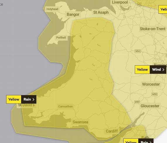
The Met Office have issued several weather warnings as heavy rain and winds as high as 70mph are expected over the next few days.
On Friday afternoon, Stagecoach tweeted "Due to poor weather conditions there may be service delays to our T4 & T14 in & out of Cardiff. This may also effect our X75 Sorry for any inconvenience caused".The services run from Cardiff to Newtown and to Hereford, and pass through Brecon, Builth, Llandrindod Wells and Hay-on-Wye.An area of low pressure is set to move across the UK on Saturday which is expected to bring heavy rain in Wales throughout Friday evening and overnight into Saturday.
This has prompted the Met Office to issue a yellow weather warning, beginning at midday on Saturday and lasting for 24 hours, which includes the whole of Powys.
Chief Meteorologist, Paul Gundersen, said: “This weekend we’ll see another named Storm bring strong winds to parts of the UK with several wind and rain warnings in place.


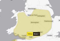
“South-westerly winds will strengthen through Saturday morning and it’ll turn widely windy, with wind warnings in place for Northern Ireland, Wales, southern Scotland and much of England. Where warnings are in place gusts of 50-60mph are likely quite widely with 65-70mph possible in coastal areas.”
Areas of Wales could be hit by between 60-80mm of rainfall on Saturday with the possibility of showers falling as hail, sleet or snow.
The Met Office has warned that with rain falling on already saturated ground, further flooding is possible in places.
Storm Jorge, which was named by the Spanish Meteorological Service on Thursday, will not take the name Ellen, which was next on the UK’s list of storm names.
The Met Office has warned on their website that the different name should not influence the response to warnings:
“The weather over the weekend could have impacts due to the strong winds and those in the warning areas should take the advice of local emergency services seriously.”
Forecasts are unclear for next week, although a shift back to colder conditions is expected with a chance of wet and windy weather returning around the middle of the week.
You can check your flood risk and stay up to date with flood warnings in your area by checking the Natural Resources Wales website.A flood alert has been issued for the River Usk as river levels are expected to rise overnight on Friday, February 28.The Upper Towy and Rivers Bran and Gwydderig also have flood alerts as heavy rainfall is expected to be brought over by Storm Jorge until 5am on Saturday, February 29. The warning by Natural Resources Wales said: “The combination of ground conditions, existing river levels and forecast rainfall quantities gives a high risk of flooding of low-lying land over the weekend”.